
GIS-backed mapping, location scoring and document enhancement services providing marketing, evaluation and decision-making solutions to owner, occupier-side real estate participants.
GIS-backed mapping, location scoring and document enhancement services providing marketing, evaluation and decision-making solutions to owner, occupier-side real estate participants.

EMPIRICAL LOCATION VIZ
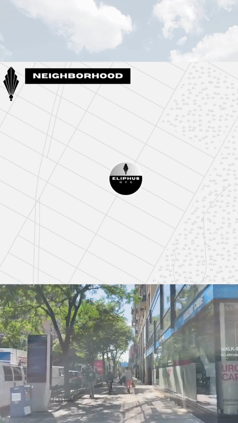
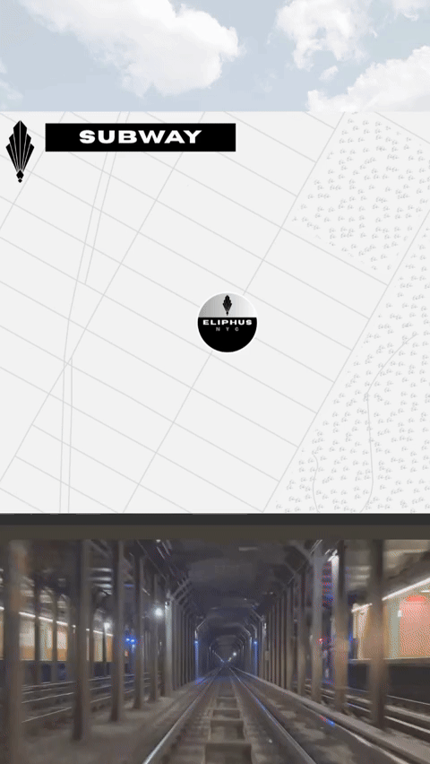
With Motion Maps, Geosimulate’s flagship offering, landlords, developers and others can clearly communicate a location’s most compelling attributes with categorical separation, sequenced storytelling, zoom-level optimization, the general curiosity that comes with motion and more! Combine Motion Maps with Social or Static Maps for a Map Campaign.
Visit Motion Maps below or click here.

For the ultimate in visualized location communication, Motion Maps Campaigns enable groups to make compound points with coordinated mapping for web & presentations with possible extension to Social Media.
MOTION MAPS CAMPAIGNS


Geosimulate offers enterprise-level geographical information systems (“GIS”) analysis, advanced cartographic design and related services to a wide array of businesses.
FOR LANDLORDS
Showcase a location’s most compelling attributes using categorical separation, sequenced storytelling and zoom-level separation with MOTION MAPS. Engage large and new audiences by adding entertaining elements and purposed aspect ratios with SOCIAL MAPS. Impress building visitors and others when print is ideal with design cartography with STATIC MAPS. Dazzle with longer map-based video with GEOSTUDIO. Make indisputable statements about locations for use in marketing, proposals and other materials with MAP FACTS. Differentiate from competitive offerings or Select from candidate investments with MAP TABS.
& developers, other site proponents
FOR TENANTS
Showcase a location’s most compelling attributes, including accessibility and nearby amenities for employees and clients/customers using categorical separation, sequenced storytelling and zoom-level separation with MOTION MAPS. Popularize next expanded location amonst the masses with SOCIAL MAPS. Canvass next locations, Select from candidate locations, or Build consensus among stakeholders with MAP TABS.
& other space-occupying businesses
Campaign demonstrates motion maps, motion maps collections and social media collections.
VISIT ELIPHUS

NEW!
Motion Maps allows landlords, developers and others to clearly communicate a location’s most compelling attributes. Using categorical separation, sequenced storytelling, zoom-level optimization and other methods, visual communication of key competitive advantages can be communicated through websites, presentations, digital media and direct outreach. Motion Maps are custom generated by Geosimulate cartographic designers and can be coordinated with social campaigns, GeoStudio movie productions and more.
MOTION MAPS


STAYING ON BRAND
Geosimulate mapping services are provided by experienced analytical and design cartographers to ensure maps are consistent with owner/developer, park and/or building-level branding. Mapping is delivered to ensure a seamless coordinated appearance within websites, presentations and other display spaces. Geosimulate offers a full spectrum of color offerings and more than 2,000 fonts. We are also delighted to receive and adhere to your brand standards. Most important is a visual impact that delivers the point you want to make, in the syle you want to make it.
Our static mapping services enable location owners/advocates to communicate a limited number of critical points for boarded presentations or any other circumstance where the ability to display motion is limited.
STATIC MAPS


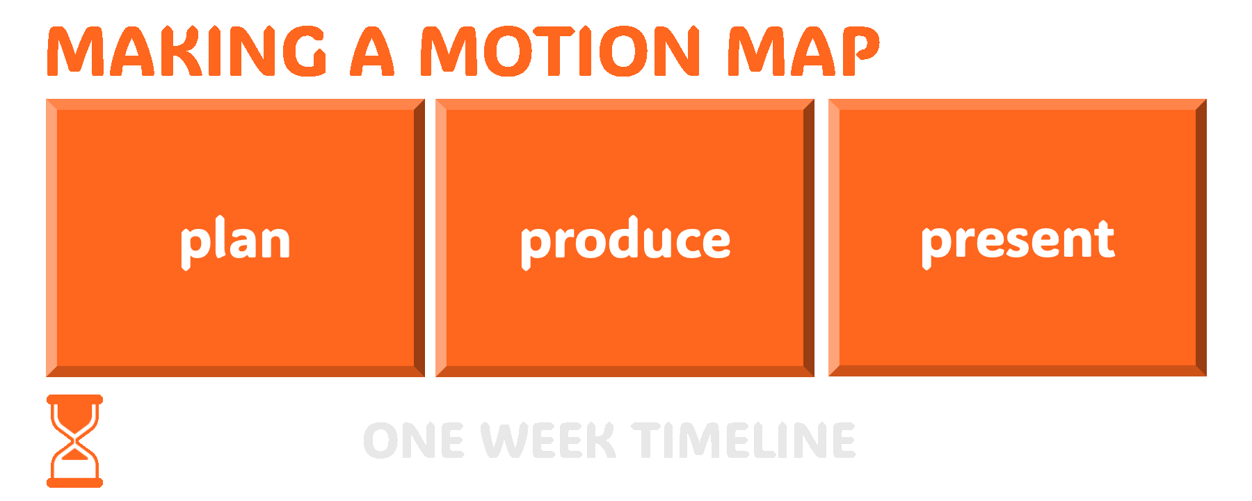
Static maps are conceived through initial consulting with the client, and typical timing for the production of a static map is one week, with rush service available when possible.
For locations with powerful stories to be told, Geosimulate is available to create 4K-quality compound movie experiences with multiple views, data overlays and facts about location superiority. GeoStudio movies can be added to websites, posted to YouTube channels (included promotion via Geosimulate), distributed via social media and even produced for specific, high-value clients and targets.

Geosimulate renders in 4K Ultra HD resolution.

Geosimulate can generate map-based factual statements that can make tangible aspects of a location that are usually just made generally, optimizing effectiveness and reach.
MAP FACTS

Compare alternatives across critical map-based and other criteria using patented "criteria tree" and GEOSCORE methodologies.
MAP TABS
PEOPLE

Brendan Carroll, Partner


Brendan Carroll is the founder of Geosimulate. Having founded Respoke, Geosimulate’s predecessor company in 2022, Mr. Carroll has more than 20 years experience in real estate and geostatistical analysis. Prior to founding the Company, Mr. Carroll served as the Director of Life Sciences Research, Americas for Cushman & Wakefield and has had numerous prior roles in Greater Boston and nationally-focused real estate analytics. Mr. Carroll has been named a BISNOW real estate market leader and one of the “People to Watch” in commercial real estate, by Commercial Property Advisor Magazine. Brendan lives in Boston, Massachusetts.
PRESS & MEDIA
Media Appearances
Includes appearances as Respoke LLC, may require subscription to view
Geosimulate’s expertise extends to the realm of social media, optimized for use across all major platforms.
SOCIAL MAPS
click img to play on IG
View Geosimulate on Instagram, on YouTube, on X, or on LinkedIn.