

ABOUT

Geosimulate is a provider of next-generation advisory services optimized for real estate decision-making. Its solutions enable a diverse client base to make Geographical Information Systems (“GIS”)-assisted decisions leading to optimal realizing of investment return and other strategic goals. Vid at YT
Market Canvassing
|
Candidate Evaluation
|
Asset Marketing
|
Geographic Brainstorming
|
Market Evaluation
|
Prospectus Marketing
I
Asset Positioning
|
Market Canvassing | Candidate Evaluation | Asset Marketing | Geographic Brainstorming | Market Evaluation | Prospectus Marketing I Asset Positioning |
PRODUCTS
Hosted interactive and static mapping solutions for investment strategy analysis, optimal location selection and enhanced embedded website displays. Vid at YT
MAPPING
About Mapping
Hosted interactive market and candidate evaluation-focused tables intended to compare investment and location choices with empiracle geostatistical data variables.
RANKING
About Ranking
Consulting services optimized for asset owners/investors looking to optimally characterize portfolio assets with geostatistical advantages. Vid at YT
MARKETING
About Marketing
SOLUTIONS
-
Interactive mapping solutions intended to illustrate attractive potential areas of investment given a party’s investment preferences.
-
Table solutions designed to rank identified alternative assets and markets given party’s investment preferences.
-
Static, interactive and video mapping and map-based data solutions intended to demonstrate attractiveness of location from an investment perspective.
-
Static, interactive and video mapping and map-based data solutions intended to demonstrate location attractiveness to potential occupiers.
-
Static, interactive and video mapping and map-based data solutions intended to demonstrate attractiveness of location from an investment perspective.
-
Static, interactive and video mapping and map-based data solutions optimized for viewing by a large audience.
OWNER/INVESTOR
-
Table solutions designed to rank identified alternative assets and markets given location priorities, including existing and potential workforce accessibility.
-
Static, interactive and video mapping, along with map-based documentation to communicate location selection goals and choices with employees and other internal stakeholders.
-
Static, interactive and video mapping, along with map-based documentation to communicate location selection goals and choices with customers and media.
OCCUPIER
-
Static, interactive and video mapping and map-based data solutions intended to demonstrate attractiveness of location from an investment perspective.
-
Static, interactive and video mapping and map-based data solutions intended to demonstrate features available to existing business and individuals.
PUBLIC
February’s Map of the Month is for a hypothetical client interested in residential infill development within the City of Chicago. Geosimulate, with the client, developed a list of candidate locations of low-rise development and land sites, then generated a map based on the agreed below criteria. We then further overlayed a close, five-minute walking radius from stations on the Chicago “El” rapid transit system.
M.O.M: CHICAGO RESI

GROWTH

Annual pop growth > 0.5%
Pop. density >10,000 ppsm

DENSITY
EDUCATION

Adults >40% bachelor’s degrees
>100 bars/restos per sm

FUN
WEALTH

>2,000 w >$500k assets per sm
Personal crime index <300

SAFETY


Geosimulate on Social

Visit us at youtube/@geosimulate for about videos, case studies, real-world applications and more! Geosimulate on YouTube is your resource for understanding how geostatistics can help your business. Visit us at instagram/geosimulate to check out some of our latest incorporations of map-generated data into compelling visual material.
Key Personnel

Brendan Carroll
Brendan Carroll is the founder of Geosimulate. Having founded Respoke, Geosimulate’s predecessor company in 2022, Mr. Carroll has more than 20 years experience in real estate and geostatistical analysis. Prior to founding the Company, Mr. Carroll served as the Director of Life Sciences Research, Americas for Cushman & Wakefield and has had numerous prior roles in Greater Boston and nationally-focused real estate analytics. Mr. Carroll has been named a BISNOW real estate market leader and one of the “People to Watch” in commercial real estate, by Commercial Property Advisor Magazine. Brendan lives in Boston, Massachusetts.
President


FAQ
-
At present, Geosimulae services all start with in-person, virtual or email consultation. Use the contact form below or email us at inquiry@geosimulate.com to get started.
-
Geosimulate projects vary widely in time to completion. Smaller projects can be substantially completed within 24 hours or even same-day while few projects take longer than one week from start to completion. Geosimulate can usually offer a proposed completion timeline upon initial consultation.
-
All consulting services include a one-year cloud-hosted environment. Annual renewals are available for a nominal cost.
-
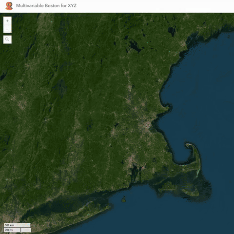
Geosimulate offers its core services across the 50 United States. A more limited set of services outside the 50 states are available if desired. Geosimulate has developed enhanced services for its home market in Boston, Massachusetts, particularly focused on the biotechnology and technology industries.
-
Geosimulate offers a standard non-disclosure agreement in connection with its services. This is to ensure the client is able to receive the maximum benefit of Geosimulate services. Geosimulate will also review a client-generated NDA, if desired.
-
Geosimulate is the new brand of Respoke LLC, launched in May 2024. Respoke LLC remains the official entity.

Press & Media
Media Appearances
Includes appearances as Respoke LLC, may require subscription to view